
Environment
Internationally Recognized Company, Earthquake Protection Systems, at Mare Island
|
Mare Island is home to many businesses and headquarters, warehouse and manufacturing plants and other industrial marvels, which service not only the Bay Area, but also the national and international markets. Earthquake Protection Systems, Inc. is one of the latter. A world leader in seismic isolation design and manufacturing, Earthquake Protection Systems (EPS) has the highest engineering qualifications, technology advanced products, the broadest implementation experience and the most comprehensive manufacturing and testing. EPS applies advanced seismic isolation technology to the design and construction of resilient and sustainable facilities that can function after an earthquake, helping to preserve and protect contents, non-structural components and structures from damage. The manufacturing plant is located on 12-acres, and with 130,000 square-feet of manufacturing space, EPS has a complete in-house fabrication capability and has a production capacity of more than 3,000 seismic bearings per year. Real time earthquake simulation testing is typically performed for every bearing, providing realistic verification of the bearing design properties and capacities.
EPS has worked on the San Francisco International Airport Terminal, and was designed by Skidmore, Owings and Merrill to resist a magnitude 8 earthquake on the nearby San Andreas Fault. The Friction Pendulum bearings provide a three-second isolation period and will reduce earthquake force demands on the building by 70 percent. The Cathedral of Christ the Light in Oakland also had work done by EPS to use Friction Pendulum seismic isolation bearings to support a 120-foot tall sanctuary, which incorporates glulaminated timber, reinforced concrete, high strength steel, and aluminum and glass to create a light-filled structure.
As part of Apple’s second campus, EPS is fabricating seismic isolators for the buildings “spaceship” style structure. Across the world, EPS has worked on the repair/retrofit of a portion of the Trans-European Motorway in northwestern Turkey that was significantly damaged in the 1999 Duzce Earthquake. The 536 Friction Pendulum bearings were installed in all four of the major Bolu-Viaducts structures of the motorway. Additionally, EPS assisted the Public Gas Corporation of Greece in selecting and installing Friction Pendulum bearings for two large Liquefied Natural Gas storage tanks on the island of Revithoussa, near Athens, in one of Europe’s highest seismic regions. Earthquake Protection Systems is located in Building 759 at 451 Azuar Drive on Mare Island. To learn more about EPS, visit their website www.earthquakeprotection.com |


Activism
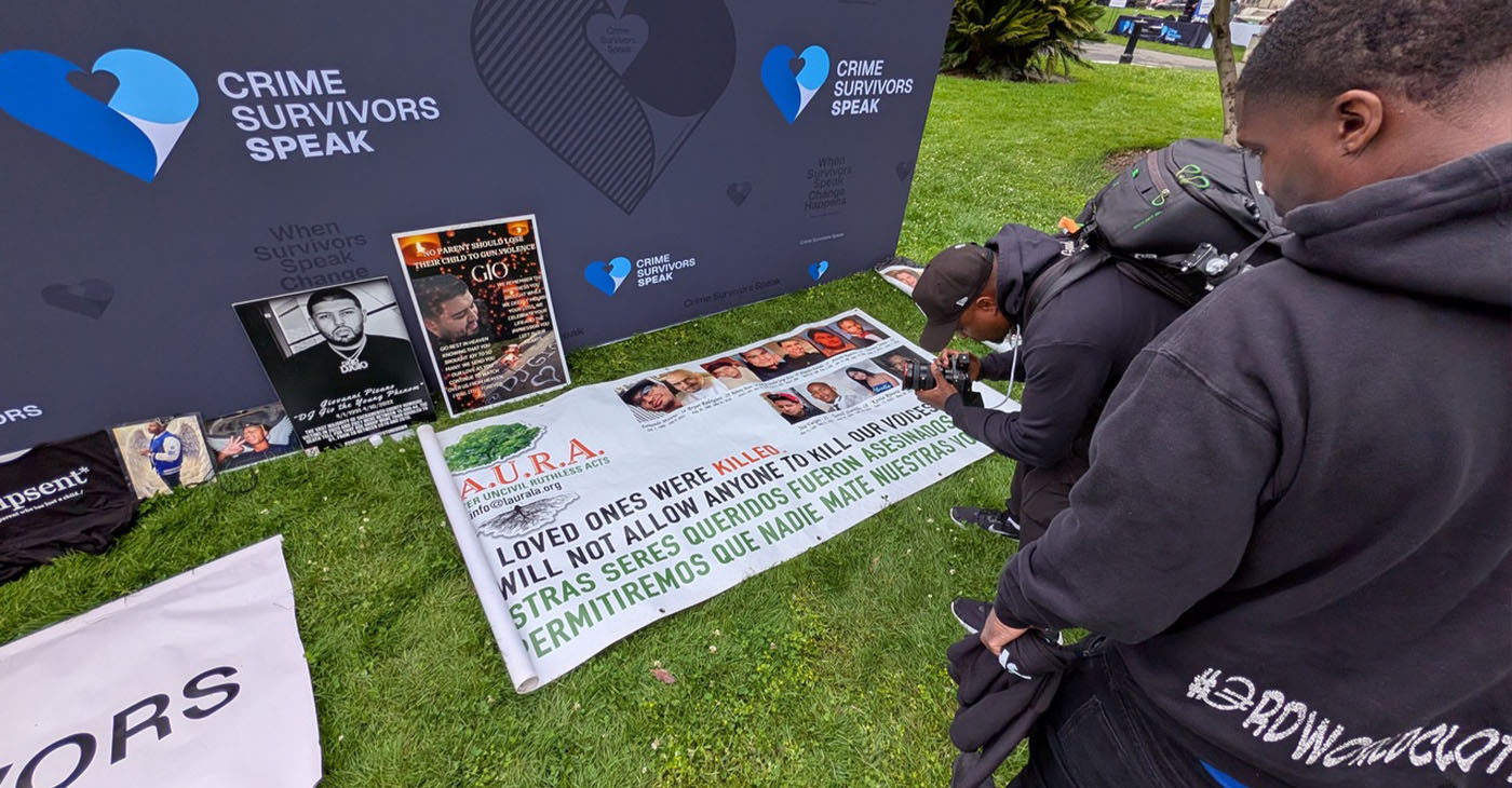
Advocates Rally at State Capitol to Demand Heat Protections for Incarcerated People; More Funding for DV Survivors
On May 4, Assemblymember Mike Gipson (D-Carson) spoke at the Survivors Speak California Rally at the State Capitol to advocate for AB 2499, which focuses on heat and health protections in state prisons. The three-day event was organized by Californians for Safety and Justice, a project of the Crime Survivors for Safety and Justice network.
By Antonio Ray Harvey, California Black Media
In July 2024, Adrienne Boulware, a 47-year-old mother and grandmother, died from complications related to extreme heat exhaustion while incarcerated at the Central California Women’s Facility (CCWF) in Chowchilla, according to her family.
Assemblymember Mike Gipson (D-Carson) hopes his legislation, Assembly Bill (AB) 2499 — also known as the “Adrienne Act” — will help prevent tragedies like Boulware’s death in California prisons.
“It is no secret that our state prisons have aging infrastructures that have inadequate ventilation systems,” Gipson said. “It should come as no shock that indoor temperatures in these facilities exceed 90 degrees, which means it gets really hot.”
On May 4, Gipson spoke at the Survivors Speak California Rally at the State Capitol to advocate for AB 2499, which focuses on heat and health protections in state prisons. The three-day event was organized by Californians for Safety and Justice, a project of the Crime Survivors for Safety and Justice network.
Boulware’s family attended the rally in support of the measure, which would require the California Department of Corrections and Rehabilitation (CDCR) to establish a pilot program to address extreme heat by July 1, 2027, in at least three prisons across different climate zones.
Boulware’s daughter, Michela Nelson, said her mother frequently complained about heatwaves during the summer months. CDCR stated that Boulware’s death — she was also known as “Twin” — appeared to be related to pre-existing medical conditions rather than extreme heat.
“My mother was not just a mother of four and grandmother of 12. She was a mother to many inside and outside of the prison,” said Nelson, the eldest of Boulware’s children. “My mother didn’t die because she was sentenced to death. She died because she was left in conditions no human being should ever endure.”
AB 2499 would formally create the Climate Justice in Prisons Emergency Response Act. The legislation would require CDCR to develop a long-term plan to install heating, ventilation, and air conditioning (HVAC) systems and shade structures in existing facilities.
The Survivors Speak California Rally coincided with other advocacy events at the Capitol supporting survivors of violent crime.
On May 5, Jazz LedBetter and other advocates rallied nearby to urge lawmakers to include $100 million in the state budget for domestic violence and sexual assault services.
Assemblymember Pilar Schiavo (D-Chatsworth) and Sen. Susan Rubio (D-Baldwin Park) served as keynote speakers. Both lawmakers have publicly shared their own experiences as survivors of assault.
LedBetter, a survivor of human trafficking, is also an author, activist, and artist who uses her experiences to advocate for human trafficking prevention. She shares her story of survival, addiction, and recovery in her self-published book, “Harlot Heart: Tributes To Triumph.”
“Take a moment and think about someone finally reaching out for help, and there’s no one here to answer,” LedBetter said during her presentation on the east lawn of the Capitol.
Advocates said the funding is needed to help close a gap caused by a sharp decline in federal Victims of Crime Act (VOCA) funding.
“I am here because I am proof of what happens when someone gets support. Don’t let this funding (shortfall) be the reason someone doesn’t make it out,” LedBetter said. “The difference between survival and unfortunately common sad stories is whether or not someone is there (to help) when it matters the most.”
Activism
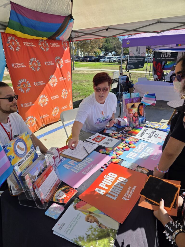
Equality California Confronts Persistent Hate, Expands Its Outreach as Need for Support Grows in State
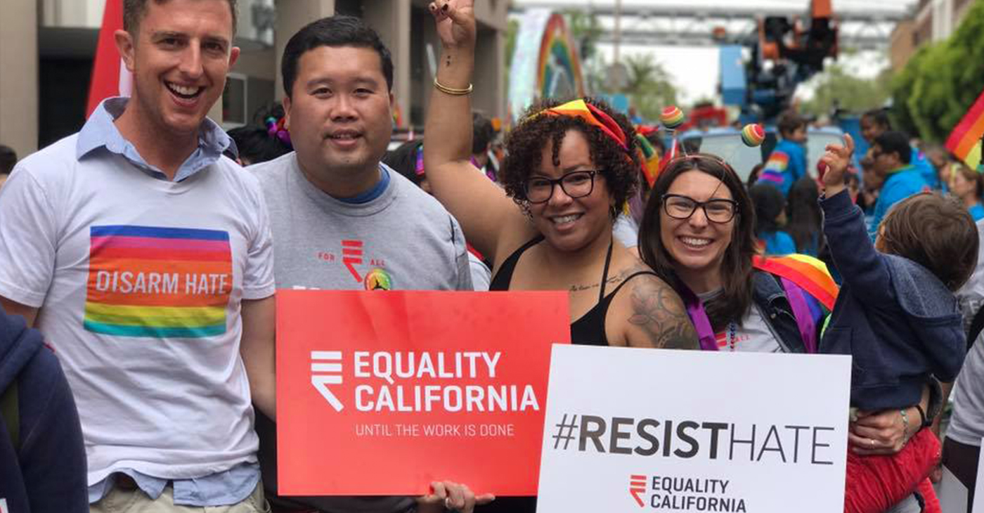
Equality California’s outreach at events like Pride includes connecting community members to resources such as CA vs Hate, a statewide, non-emergency hate crime and incident reporting hotline and online portal created to help counter a more than 50% increase in reported hate crimes in California between 2020 and 2024.
By Joe Kocurek
California Black Media
Even though public attitudes have shifted, advocates say the fight for LGBTQ rights in California remains far from over — a reality Equality California confronts through outreach, policy advocacy and community support.
“I was at Sacramento Pride,” said Erin Arendse, program director for Equality California. “We were setting up and an individual was yelling horrific homophobic slurs at everybody.”
Equality California’s outreach at events like Pride includes connecting community members to resources such as CA vs Hate, a statewide, non-emergency hate crime and incident reporting hotline and online portal created to help counter a more than 50% increase in reported hate crimes in California between 2020 and 2024.
Run by the California Civil Rights Department (CRD) and 211-in partnership with community-based organizations—the hotline and online resource offer confidential, anonymous reporting that is separate from law enforcement and grounded in a trauma-informed, victim-centered approach.
Arendse says after the incident she decided to take her own advice.
EQCA at the Los Angeles LGBT pride parade in 2011. Photo courtesy of Wiki Commons
“We were literally doing that outreach there,” she said. “So, I pulled CA vs Hate on my phone to report the incident.”
New data from CRD underscores the growing reliance on the program. CA vs Hate received nearly 1,000 reports of hate from across 46 counties in 2025 and has responded to more than 6,800 requests for help since launching in May 2023.
“Everyone deserves support after experiencing hate,” said Business, Consumer Services, and Housing Secretary Tomiquia Moss. “Through CA vs Hate, Californians have a trusted place they can turn to, and thousands of people have already reached out. From mental health counseling to legal assistance, the hotline is a nation-leading example of how we can drive real impact when we work together with our local partners.”

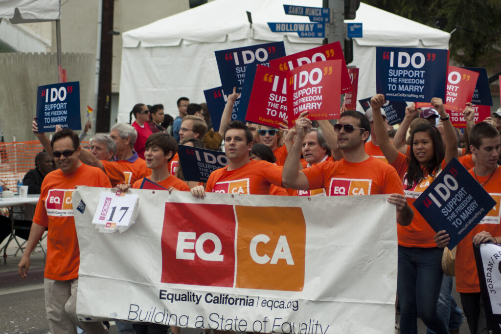
Californians protesting Prop 8, a 2008 ballot measure that would ban same-sex marriages in the state. EQCA would be instrumental in passing Proposition 3 in 2024, which would ensure same-sex couples retained the right to marry. Credit: ID 7261410 © Karin Hildebrand Lau | Dreamstime.com
According to the 2024 California Health Interview Survey from UCLA, nearly 3.1 million Californians ages 12 and over experienced hate acts in the previous year, with 31% reporting unmet support needs. Anonymous reports, including those like Arendse’s, help strengthen data collection and improve prevention and response strategies.
“People have expressed a feeling of empowerment,” she said. “It’s important to be able to say that something happened and to have that recorded and validated.”
Equality California’s work builds on decades of advocacy. In the early 2000s, the organization helped push the marriage equality debate forward by sponsoring legislation and advancing legal protections for same-sex couples, efforts that helped shift public opinion despite initial legislative setbacks.
EQCA Instagram Page (@EQCA) promoting CA vs Hate Hotline Photo courtesy of EQCA/
The group has since backed a range of policies, including expanding domestic partnership rights, protecting transgender Californians, improving support for older LGBTQ+ residents, and recognizing LGBTQ+ contributions to the state.
After voters approved Proposition 8 banning same-sex marriage, Equality California led opposition efforts and legal challenges. The issue was ultimately resolved by the U.S. Supreme Court’s 2015 Obergefell v. Hodges decision legalizing same-sex marriage nationwide.
Still, advocates say progress has not been linear.
The 2016 election ushered in a resurgence of anti-LGBTQ rhetoric, prompting Equality California to open a Washington, D.C. office in 2017 to counter federal policy threats. At the local level, tensions have also surfaced.
“A lot of school board meetings were totally overrun by anti-LGBTQ activists and specifically anti-trans organizers who would just say some of the most horrific things,” Arendse said. “A lot of school board trustees just simply were not prepared to deal with that level of vitriol in a school board meeting.”

Campaign: EQCA multi-lingual public outreach and education efforts are critical to advancing social justice and creating safer communities for LGBTQ people. Photo courtesy of EQCA
In response, Equality California, which has received support from California’s Stop the Hate Program, has worked with school districts to manage disruptions and protect students, while expanding education and training efforts. The organization has trained more than 5,000 health and human service providers on inclusivity and cultural competency.
Matt Pennon, who has overseen diversity, equity and inclusion programs at both the County and City of San Luis Obispo, said those trainings have had a measurable impact.
“The resounding feedback was ‘Wow, I actually did get something from this,’” Pennon said.
“Even the folks that maybe don’t fully agree said they developed a better sense of respect,” he added. “This is about really highlighting the differences between all of us as humans and how those differences are actually strengths.”
More recently, Equality California has raised concerns about federal policy shifts affecting transgender healthcare access.
“We’re talking access to mental health supports and basic healthcare that everybody deserves that is being blocked just because people are trans or non-binary,” Arendse said.
At the same time, advocates are revisiting past victories to ensure they are protected. After the fall of Roe v. Wade, Equality California moved to safeguard marriage equality at the state level.
“When Roe fell, we knew we had to codify these things into law, because we can’t just rely on a Supreme Court case to protect our rights,” Arendse said.
The organization sponsored a constitutional amendment to enshrine marriage equality into California law. Proposition 3 passed in 2024 with more than 62% voter support.
For Equality California, the arc of progress requires constant attention.
“Fortunately, we have that great protection in place now,” Arendse said. “I can’t believe we’re doing this again, but here we are.”
Get Support After Hate:
California vs Hate is a non-emergency, multilingual hotline and online portal offering confidential support for hate crimes and incidents. Victims and witnesses can get help anonymously by calling 833-8-NO-HATE (833-866-4283), Monday to Friday, 9 a.m.–6 p.m. PT, or online at any time. Anonymous. Confidential. No Police. No ICE.
This story was produced in partnership with CA vs Hate. Join them for the first-ever CA Civil Rights Summit on May 11, 2026. More information at www.cavshate.org/summit.
Bay Area
CITY OF SAN LEANDRO STATE OF CALIFORNIA PUBLIC WORKS DEPARTMENT ENGINEERING DIVISION NOTICE TO BIDDERS FOR ANNUAL STREET OVERLAY/REHABILITATION 2019-21 – PHASE III
WORK DESCRIPTION: The work to be done consists of roadway paving, base cement stabilization, concrete curb ramps, driveways, sidewalks, curbs and gutters, traffic detection loops and pavement striping, and doing all appurtenant work in place and ready for use, all as shown on the plans and described in the specifications with the title indicated in Paragraph 1 above, and on file in the office of the City Engineer. Reference to said plans and specifications is hereby made for further particulars.

PROJECT NO. 2020.0050
BID NO. 25-26.011
- BID OPENING: The bidder shall complete the “Proposal to the City of San Leandro” form contained in the Contract Book. The proposal shall be submitted in its entirety. Incomplete proposals will be considered non-responsive. Sealed bids containing the completed Proposal Section subject to the conditions named herein and in the specifications for ANNUAL STREET OVERLAY/REHABILITATION 2019-21 – PHASE III/PROJECT NO. 2020.0050 addressed to the City of San Leandro will be received at City Hall, 835 East 14th Street, 2nd Floor San Leandro at the office of the City Clerk up to 3:00 p.m. on Thursday, March 19, 2026, at which time they will be publicly opened and read.
- WORK DESCRIPTION: The work to be done consists of roadway paving, base cement stabilization, concrete curb ramps, driveways, sidewalks, curbs and gutters, traffic detection loops and pavement striping, and doing all appurtenant work in place and ready for use, all as shown on the plans and described in the specifications with the title indicated in Paragraph 1 above, and on file in the office of the City Engineer. Reference to said plans and specifications is hereby made for further particulars.
- OBTAINING THE PROJECT PLANS AND CONTRACT BOOK: The project plans and Contract Book may be obtained free of charge from the City’s website at:https://www.sanleandro.org/Bids.aspx Bidders who download the plans are encouraged to contact the City of San Leandro Public Works Department Engineering division at 510-577-3428 to be placed on the project planholder’s list to receive courtesy notifications of addenda and other project information. Project addenda, if any, will be posted on the website. A bidder who fails to address all project addenda in its proposal may be deemed non-responsive.Bidders may also purchase the Project Plans and Contract Book from East Bay Blueprint & Supply Co., at 1745 14th Street, Oakland, CA 94606; Phone Number: (510) 261-2990 or email: ebbp@eastbayblueprint.com.
- PRE-BID CONFERENCE: A mandatory pre-bid conference will be held on Tuesday, February 24, 2026, at 2:00 PM and on Wednesday, February 25, 2026, at 10:00 AM as follows:
Tuesday, February 24, 2026, at 2:00 PM
Zoom Meeting ID: 883 8752 6074
Passcode: 502955
Zoom Link: https://sanleandro-org.zoom.us/j/88387526074?pwd=hZ5rjB8AWdLAUem3CtByFiZxqKarHj.1
And - Wednesday, February 25, 2026, at 10:00 AM
Zoom Meeting ID: 898 2672 0472
Passcode: 091848
Zoom Link: https://sanleandro-org.zoom.us/j/89826720472?pwd=JgZX2nXMpLSRM5xDPr7EJUxl7QIznr.1The information presented at the conferences will be identical, all bidders must attend one of the pre-bid conference and sign the attendance sheet. A firm that didn’t attend the pre-bid conference isn’t qualified to bid on the project.Questions regarding the plans and specifications may be submitted in writing to the project engineer until 5:00 p.m. five (5) days before, excluding Saturdays, Sundays and Holidays, bids must be received by the City. The City will not respond to oral questions outside of the pre-bid conference. The response, if any, will be by written addendum only. Oral responses do not constitute a revision to these plans or specifications. - VALUE OF WORK: The Engineer has estimated that the value of work is between $1,000,000 and $5,000,000.
- SAN LEANDRO BUSINESS PREFERENCE AND PARTICIPATION GOALS: The work performed under this contract is subject to Section 1-6-225 of the San Leandro Municipal Code regarding local business preference and participation. A list of companies that hold a San Leandro business license is located on the City webpage under the finance department, here: https://www.sanleandro.org/340/Business-License
- SAN LEANDRO COMMUNITY WORKFORCE AGREEMENT: The work performed under this contract is subject to the Community Workforce Agreement adopted by City Council Resolution 2015-104. Contractors attention is directed to Section 10.
Dated: February 13, 2026 Sarah Bunting, City Clerk


WORK FROM HOME
Home-based business with potential monthly income of $10K+ per month. A proven training system and website provided to maximize business effectiveness. Perfect job to earn side and primary income. Contact Lynne for more details: Lynne4npusa@gmail.com 800-334-0540
![]()

Diabetes in Black California: Turning the Tide from Crisis to Control

Oakland Post: Week of July 1 – 7, 2026

Prescott Circus Theatre Presents Free Summer Performance Series

NPRC Joins National Grand Jury Proceedings Seeking Accountability, Constitutional Restoration

Local Civil Rights Attorney, Activist Walter Riley Reveals Life Lessons from 70 Years in the Movement

50 Years Later, ‘Wake Up Everybody!’ Still Resonates During Black Music

Inaugural Juneteenth Awards Ceremony Celebrates the Fillmore’s Black History, Leadership and Resilience

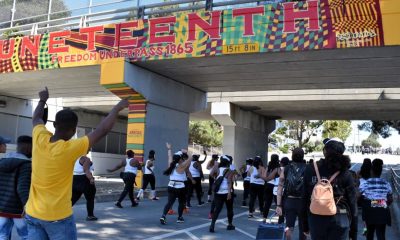
Thousands Come Out to Celebrate Juneteenth in Richmond

East Oakland COGIC Celebrates Re-Dedication

Black Repertory Group Needs Volunteers to Help Shape the Next Generation of Artists and Leaders

Oakland Post: Week of June 24 – 30, 2026


Oakland Museum Presents Landmark Retrospective Celebrating Beloved Bay Area Artist Mildred Howard

Ferry Fares to Increase July 1 as Ridership Hits Record Highs

Stop the Hate Symposium Brings Oakland Together Through Dialogue, Partnership, and Community Healing

After 10-Year Wait, Fillmore Heritage Center Reopens in San Francisco

Oakland Post: Week of June 3 – 9, 2026

Oakland Post: Week of May 27 – June 2, 2026

COMMENTARY: Black Music is the Sound of Black Freedom: Let Us Reclaim Both This Juneteenth

2026 World Cup is Here and Atlanta is Ready For It

Oakland Post: Week of June 10 – 16, 2026

Oakland Director Boots Dazzles Once Again in ‘I Love Boosters’

5 Cleveland Police Officers Injured, Gunfire Erupts During East Side Pursuit

Sale of Coliseum to African American Developers Moves Toward Completion

Oakland Post: Week of June 17 – 23, 2026

Venus Williams Calls a Sabalenka Exit a Tragedy

COMMENTARY: Using Art, Healing, And Community to Transform Mental Health Dialogue
Ferry Fares to Increase July 1 as Ridership Hits Record Highs

UC Berkeley Named Top Public University in the U.S. and No. 7 in the World by ‘U.S. News’

The Conversation With Al McFarlane 6/23/26

Media Monday 6/22/26

LIVE! ASK ALMA! — TUES. 6.23.26 7PM EST

Car Buying Secrets: 4 Hidden Checks Before You Sign!

Is This 550 HP Charger Worth YOUR Money? AutoNetwork Review

Celebrating Juneteenth – Frederick Douglass on education and resistance

LIVE! — ASK ALMA! — TUES. 6.19.26 7PM EST

Hyundai Ioniq 5 Parking, Safety, and 360 View #shorts

2025 Ioniq 5 New Wiper & Powerful Performance! #shorts

Electric SUV Range: Is 259 Miles Enough? #shorts

EV Charging: How Fast Can You Charge an Electric Vehicle? #shorts

Biometric Cooling… Messaging Seats…Come on! 2025 Infiniti QX80 Autograph 4WD

Charged Up: Witness the Magic of a Fully Electric Car! #shorts

Range Rover Sport PHEV Included…: See What’s Inside This Luxury SUV! #shorts

Invisible Hood View: Perfect Parking with X-Ray Vision! #shorts
-
 Activism2 weeks ago
 -
 Activism4 weeks ago
Oakland Post: Week of June 10 – 16, 2026
-
 Business3 weeks ago
Sale of Coliseum to African American Developers Moves Toward Completion
-
 Activism3 weeks ago
Oakland Post: Week of June 17 – 23, 2026
-
 Alameda County2 weeks ago
Ferry Fares to Increase July 1 as Ridership Hits Record Highs
-
 Bay Area2 weeks ago
UC Berkeley Named Top Public University in the U.S. and No. 7 in the World by ‘U.S. News’
-

 Arts and Culture2 weeks ago
IN MEMORIAM: Oakland Dance Legend Reginald Ray-Savage, 67
-
 Activism2 weeks ago
Oakland Museum Presents Landmark Retrospective Celebrating Beloved Bay Area Artist Mildred Howard